Find your fish before you leave port.
Daily satellite intelligence, ocean layers, ocean fronts, and fleet activity — distilled into scored fishing zones and pushed to the captain's phone before the lines come off the dock.
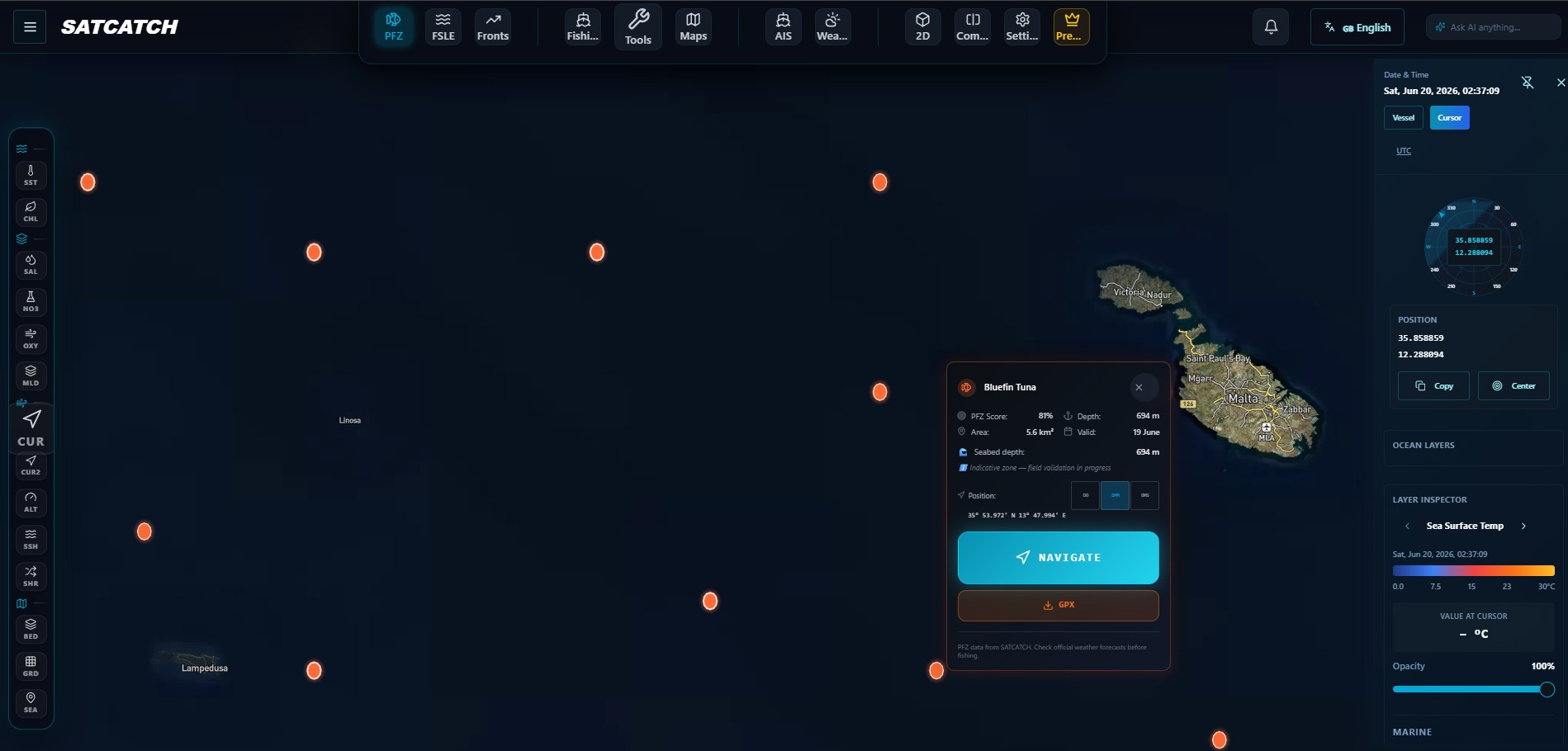
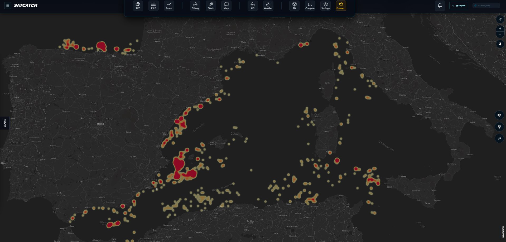
The ocean looks empty. SATCATCH shows you where it isn't.
Drag the handle. On the left, the bare sea every captain leaves port to. On the right, the same water with today's scored PFZ zones laid over it.
Pick the tier built for your boat.
Every tier ships daily PFZ zones, weather and daily refresh. The difference is coverage, targeting depth and offshore intelligence.
- ✓Daily PFZ zones, scored by confidence
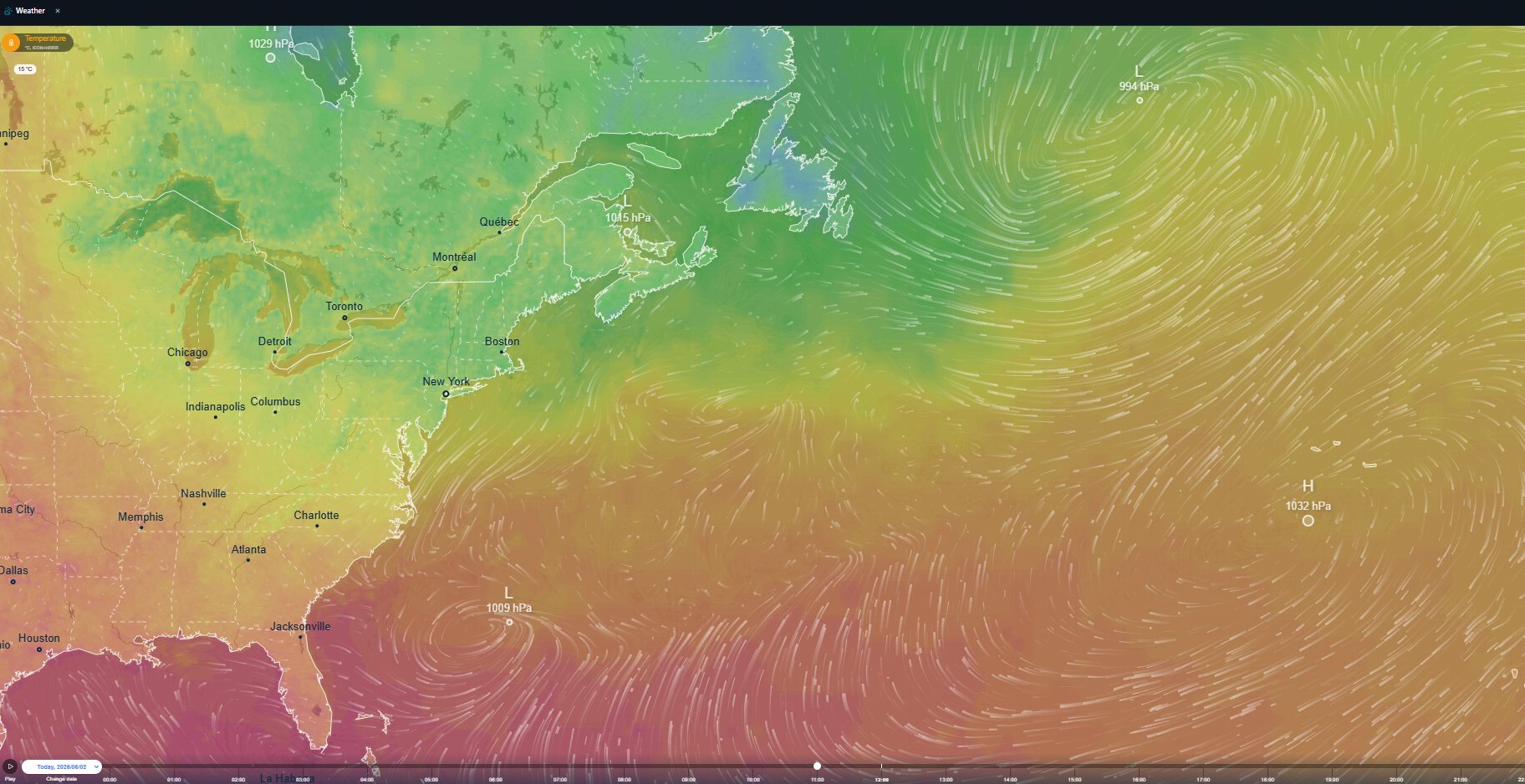
- ✓Marine weather & sea state
- ✓SATCATCH Marine Maps
- ✓Everything in Coastal
- ✓Fleet activity awareness (AIS)ADD-ON
- ✓Recent fishing activity heatmap
- ✓Historical archive
- ✓SST fronts
- ✓Chlorophyll (CHL) fronts
- ✓Everything in Pelagic
- ✓Dark-fleet detection
- ✓Seabed substrate & depth stratification
- ✓Everything in Demersal
- ✓Thermal fronts & mesoscale eddies
- ✓Offshore Swordfish & tuna targeting
33+ daily layers feeding one decision: where to drop.
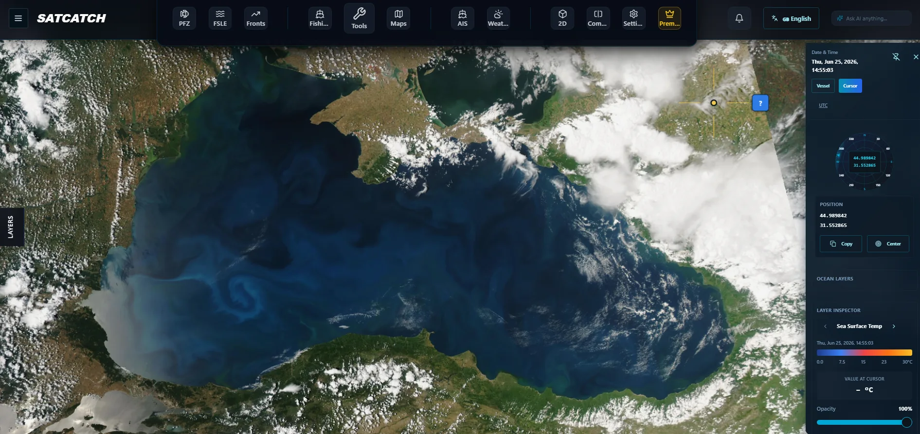
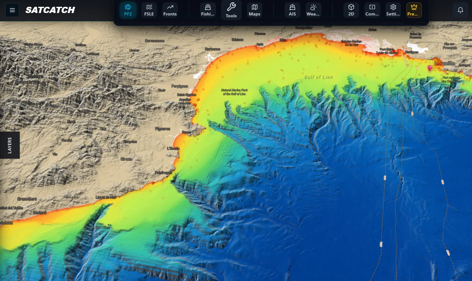
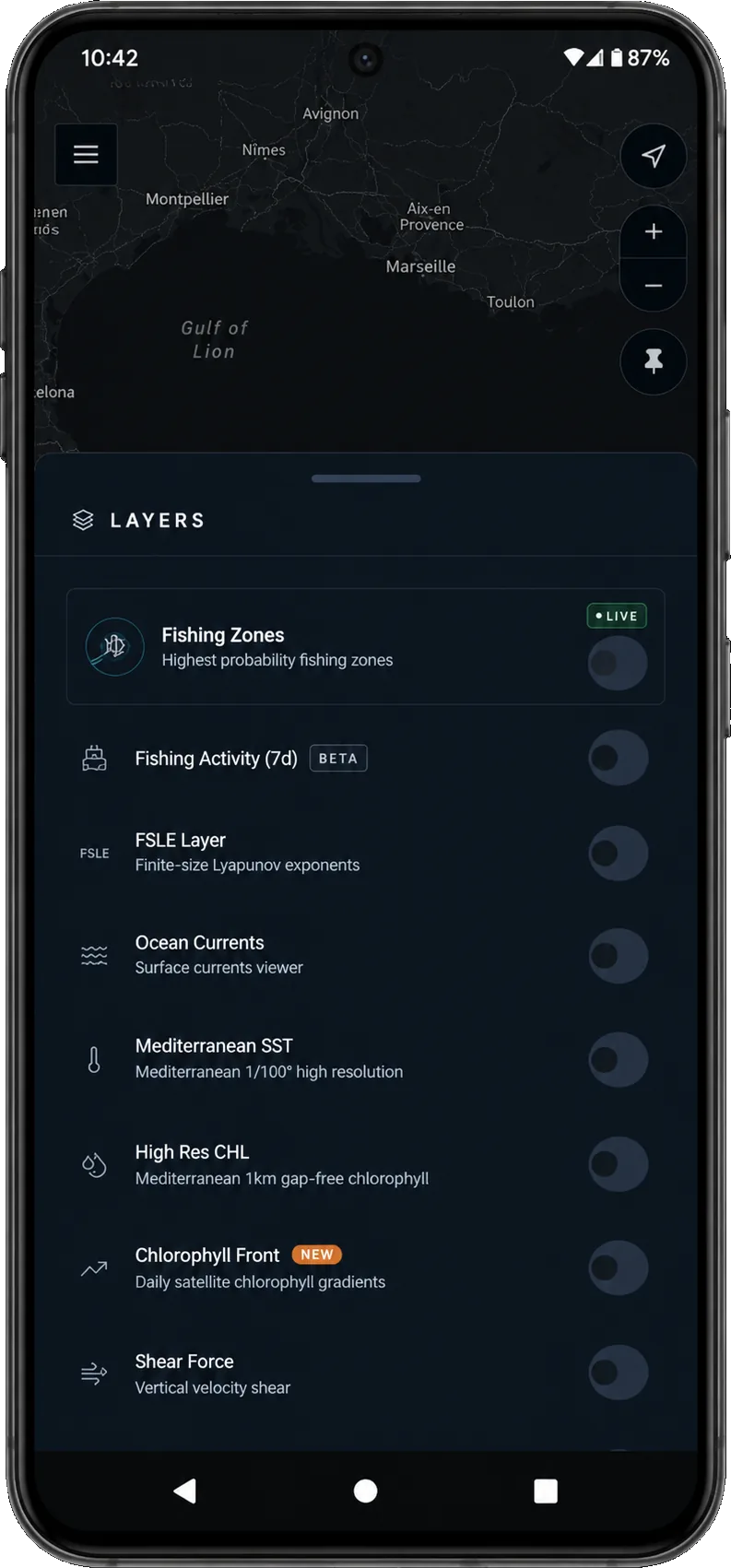
33+ ocean layers, refreshed daily.
Every layer is available in every software tier. The PFZ engine reads all of them so you don't have to.
SATCATCH Bridge — the wheelhouse upgrade.
A purpose-built onboard device that reads your sounder, GPS and AIS over NMEA 2000 — then broadcasts the SATCATCH layer to every screen on the boat. Live sonar. Offline at sea.
- ✓Full Bridge hardware unit
- ✓Live sonar (depth · temp · hardness)
- ✓Personal seabed map (v2)
- ✓OTA software updates for life
- ✓Full Bridge hardware unit
- ✓Live sonar display
- ✓Personal seabed map (v2)
- ✓Furuno · Raymarine · Garmin compatible
- ✓Priority support
- ✓Volume hardware pricing
- ✓Centralized fleet dashboard
- ✓Dedicated success manager
- ✓SLA & custom integrations
Questions captains ask before subscribing.
Satellite intelligence for sustainable fisheries.
Join the fleets worldwide using satellite intelligence every day.